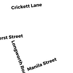
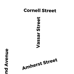
91 AMHERST ST
Owner Information
CONNOLLY,BARRY +
0091 AMHERST ST
WORCESTER, MA 01602


Property Details
91 AMHERST ST is classified as a Single Family Residential (Conventional).
The primary structure on this property was built in 1924. There are 2,317ft2 of built area within this property. There is 1,518ft2 of residential/living space within this property. This property is listed as having 7 rooms.
91 AMHERST ST is valued at $227,400. The land is valued at $65,400 and the structures are valued at $160,300. There is an additional valuation of $1,700 on this property.
This property is in Zone RS-7. Confirm with local Zoning Board authorities to ensure there are no overlays or other easements on this property.
The most recent deed for 91 AMHERST ST is recorded at the local registrar in Book 34463, Page 0190. 91 AMHERST ST was last sold on Saturday, August 28, 2004 for $234,420.
Assessment data from fiscal year 2021.
Flood Data
According to the FEMA National Flood Hazard Layer, this property does not appear to be in a flood zone. It may also be in an area not yet reviewed. Nonetheless, confirm this information prior to taking any action.
To view the flood hazards around this property, create a FEMA "Firmette" Map of the area around 91 AMHERST ST.
Broadband Internet Providers
| Provider | Type | Bandwidth (mbps) | |
|---|---|---|---|
| GCI Communication Corp. | Satellite | 0 | 0 |
| VSAT Systems, LLC. | Satellite | 2 | 1 |
| HughesNet | Satellite | 25 | 3 |
| Viasat Inc | Satellite | 100 | 3 |
| T-Mobile | Fixed Wireless | 25 | 3 |
| Charter Communications Inc | Cable | 940 | 35 |
| Verizon New England Inc. | DSL | 10 | 1 |
Broadband service provider data from December 2020.
Adjacent Properties
- 107 AMHERST ST
Single Family Residential owned by HELNARKSI,JOSEPH JR + DUNN,ERIKA - 24 LONGWORTH RD
Single Family Residential owned by TSIGAS,PANAGIOTIS + KATHERINE - 4 CRICKET LN
Single Family Residential owned by HILGAR,ARTHUR G + ELIZABETH N - 2 CRICKET LN
Single Family Residential owned by GENEST,DANIEL M + MCCARTHY,CHRISTINE M